AERIAL SURVEYING & GEO INFORMATION SERVICES
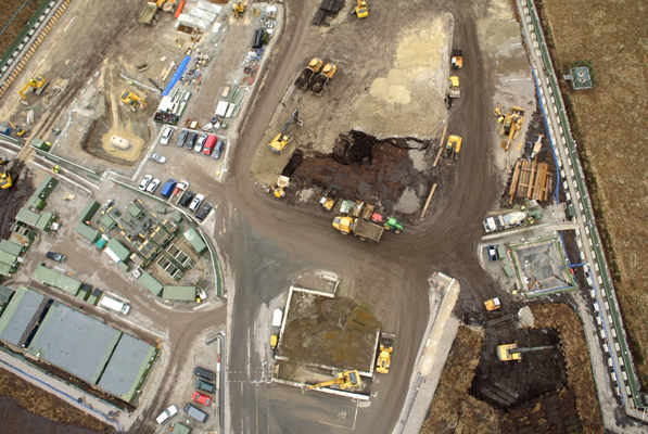
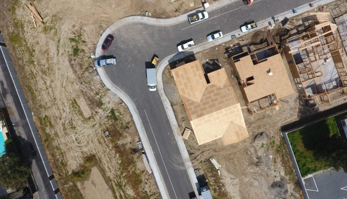
Professional aerial surveying in Australia is a core part of the UAS IMAGERY operation. Our aerial mapping services are of survey grade accuracy. We offer the ability to map extended areas quickly, safely and at a more effective cost base than a conventional manned aircraft.
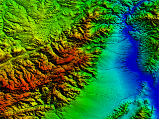
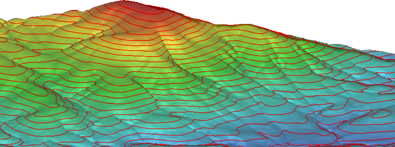
Our Geo Information services utilise enterprise grade post processing kinematics (PPK) software to provide image resolutions of down to 3 cm (1.2 inches) per pixel. Data collected can be used to create 3 dimensional terrain models including digital surface models (DSMs), digital terrain models (DTMs), digital elevation models (DEMs), contour maps or 2 dimensional orthomosaics.
All images are ortho-rectified and geo-referenced meaning that measurements including volume, area and length can all be derived straight from the output.
All post processing is done in house using state of the art image processing software.
Key Applications & Benefits
-
Terrain Mapping - DSM, DTM, DEM, Contours
- Volumetric Calculations
- Environmental Management
- Project & Infrastructure Management
- Navigate challenging terrain safely
- High resolution imagery
- 3D models
- 2D Orthomosaics