PROFESSIONAL AERIAL SURVEYING AND ASSET INSPECTION

Industry Leaders in Aerial Surveying, Asset Inspection and Remote Sensing Data Collection
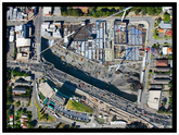
With the latest drone technology, we offer a faster, safer, and more cost-effective alternative to traditional survey methods. Our drones cover large areas and deliver accuracy levels of up to 2 cm.
At UAS Imagery, we specialize in providing data processing services for clients, turning raw data into valuable information for informed decision-making. Our team works closely with clients to deliver the data they need, tailored to their specific requirements.
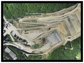
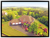
Our aerial surveying services are widely used for land planning, construction, resource management, and many other applications. We use high-precision sensors and cameras to capture data with unparalleled accuracy, allowing us to create detailed maps and models that meet clients' specific needs.
We pride ourselves on our commitment to customer satisfaction and providing high-quality aerial surveying services. Our clients trust us to deliver accurate and reliable data that helps them make informed decisions about their projects.
In addition to our data processing services, we also offer 3D modeling and visualization services to help clients better understand their data. Our 3D models can be used for a wide range of applications, including virtual site visits, simulations, and visualizations.
Overall, UAS Imagery is your go-to source for reliable, cost-effective, and high-quality aerial surveying solutions. Contact us today to learn more about how we can help you get the data you need to make informed decisions and drive better outcomes.

AERIAL SURVEYING
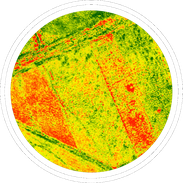
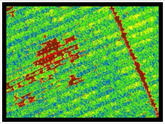
PRECISION AGRICULTURE

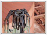
ASSET INSPECTIONS
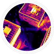
THERMAL IMAGING
INSTAGRAM